Incorporated in the Northwest Territories in 1996, Ollerhead & Associates Ltd. is a 100% Northern owned and operated firm of Canada Lands Surveyors and Engineers.
OUR SERVICES
Real Property Reports
A Real Property Report (RPR) is a legal document that confirms the location of any structures and man-made features relative to property boundaries.
Subdivision Surveys
A Subdivision Survey is carried out to establish new land parcel boundaries and the associated titles for each parcel.
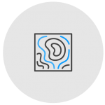
Topographic Surveys
A topographic survey maps the natural and man-made features of an area, showing elevations, contours, and physical structures for purposes such as construction and planning.
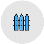
Property Boundary Surveys
A property boundary survey is a legal survey that defines the boundaries of a parcel of land, along with the location of any structures or encroachments.
Condominium Surveys
A Condominium Survey makes it possible to divide ownership of land or divide ownership of units within a building.
Mineral Lease Surveys & Claim Staking
Ollerhead & Associates Ltd. has extensive experience staking mineral claims and surveying mineral leases throughout the Northwest Territories and Nunavut. Survey crews are deployed to complete mineral claims efficiently and cost effectively.
Land Claim & Indian Reserves Surveys
Land Claim and Indian Reserve surveys document the boundaries of Indigenous land, ensuring clarity and legal recognition of their rights to land and resources.
Control Networks & Deformation Monitoring
Installing a network of high-precision control points creates a unified reference system, ensuring accuracy and consistency for all surveying and construction activities on a site. Deformation monitoring tracks changes in the position or shape of structures over time to detect movement or shifts that may signal potential issues.
Construction Surveys
We offer a comprehensive range of construction surveying services to diverse clients, including topographic and as-built surveys, pile location, facility stakeouts, and everything in between.
CAD Drafting
CAD can be defined as the use of computer systems to assist in the creation, modification and optimization of a design.
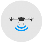
Remotely Piloted Aircraft System (RPAS)
The time and cost saving benefits of collecting information by RPAS (Remotely Piloted Aircraft Systems) are being realized by an increasing number of construction and engineering operations.
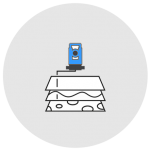
Lidar Scanning
Lidar (light detection and ranging) is commonly used to capture high-resolution, highly accurate 3D data of complex sites quickly and efficiently.
Bathymetric Surveys
Bathymetric surveys involve measuring the depth of a water body and mapping its underwater features, providing detailed insights into the seafloor or lakebed topography.
Ground Penetrating Radar (GPR)
Ground Penetrating Radar (GPR) is a non-destructive method used to detect and map subsurface features.
Void Scanning
C-ALS is a unique laser system that gives you underground mapping capabilities in inaccessible cavities.